Indiana State Geography Pack
$3.50
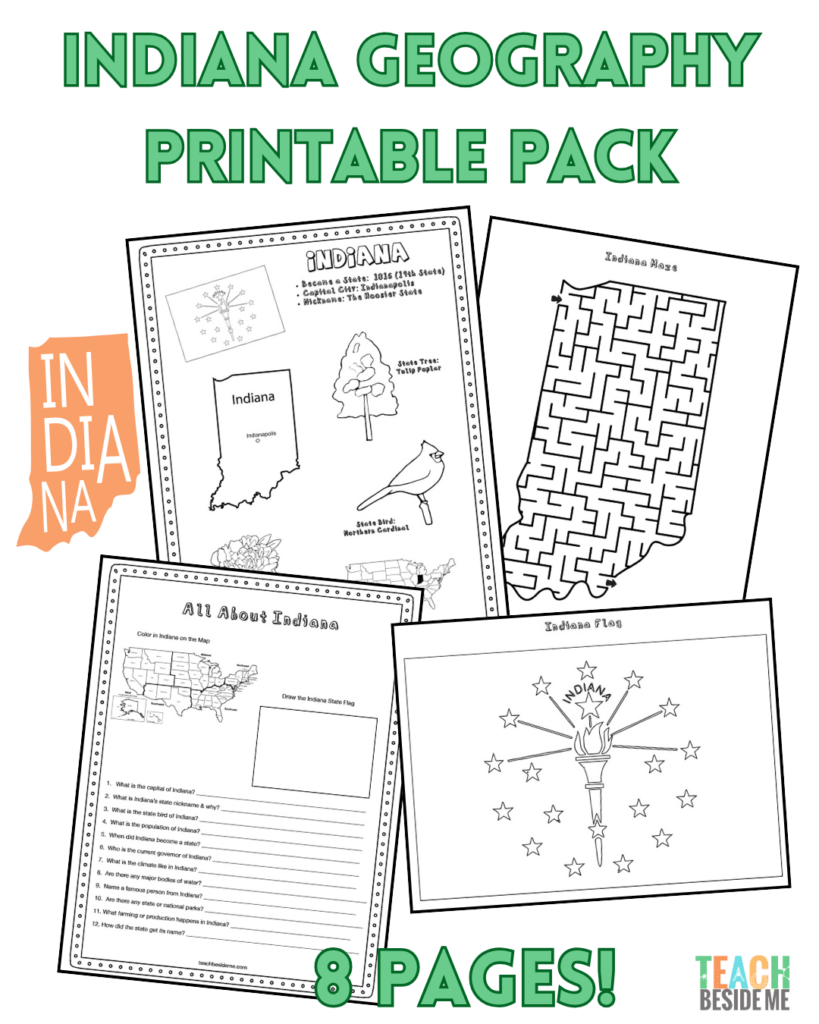
Indiana State Geography Pack – 8 Printable Pages
Explore The Hoosier State with this fun and engaging geography printable pack for kids! Students will learn about Indiana’s location, landmarks, and state symbols through hands-on maps, coloring pages, and research activities. Perfect for homeschool, classrooms, or U.S. state studies.
Includes:
• State fact coloring page
• Regional Midwest map
• Landmark coloring page (Indianapolis Motor Speedway)
• Research worksheet
• Blank U.S. map
• Indiana labeling map
• Large state flag coloring page
• Indiana-shaped maze
Just print and learn!
Description
This post may contain affiliate links.
Bring The Hoosier State to life with this interactive Indiana State Geography Pack! This 8-page printable resource helps students explore Indiana’s geography, symbols, and landmarks through hands-on learning activities.
Perfect for homeschoolers, classrooms, and U.S. state study units, this printable pack encourages map skills, research, and creativity while helping kids learn about Indiana.
What’s Included
This printable set includes 8 engaging pages:
• Indiana Fact Coloring Page – features the state bird, flower, flag, and animal
• Midwestern States Regional Map
• State Landmark Coloring Page
• Indiana Info Worksheet
• Blank United States Map
• Indiana State Map
• Large Indiana State Flag Coloring Page
• Indiana-Shaped Maze Activity
Perfect For
• U.S. geography lessons
• Homeschool state studies
• Elementary and middle school social studies
• Printable notebooking activities
• State research projects
Students will learn about Indiana’s geography, landmarks, and culture while developing map-reading and research skills in a fun and engaging way.
Simply download, print, and start exploring Indiana!