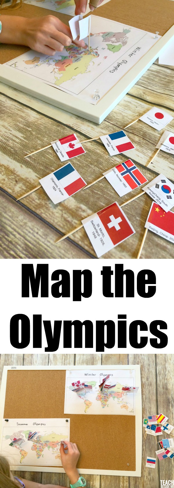
Map the Olympics
$4.50
A hands-on geography and history activity where kids map every Summer and Winter Olympic host city using printable flags and world maps. Perfect for classroom and homeschool learning.
Description
This post may contain affiliate links.
Turn the excitement of the Olympics into a meaningful geography and history lesson with this Map the Olympics Printable Set.
Students map every Summer and Winter Olympic host city from the first Games to today using printable flags and world maps. This engaging, hands-on activity helps kids explore global locations while learning how the Olympic Games have moved around the world over time.
What’s Included
-
World map for Summer Olympics
-
World map for Winter Olympics
-
Printable host country flags
-
City and year labels for each Olympic Games
-
Color and black-and-white versions
Skills Students Practice
-
World geography and map skills
-
Country and continent recognition
-
Understanding historical timelines
-
Comparing global regions and climates
Perfect For
-
Homeschool geography units
-
Classroom Olympic studies
-
World cultures and history lessons
-
Interactive bulletin board displays
This low-prep activity combines mapping, history, and global awareness into one engaging project students love.
Check out my Printables Membership to get access to my entire library of products!
See the related blog post for more details.