Idaho State Geography for Kids: Printable Learning Pack
This post may contain affiliate links.
Next up in our U.S. Geography series is Idaho—a state full of mountains, rivers, forests, and rich history. Known as the “Gem State,” Idaho is famous for its beautiful natural resources, outdoor adventures, and of course, potatoes! This printable Idaho geography pack will help kids explore the state’s unique features while building map skills and learning about U.S. geography in a hands-on way.
Studying all 50 states? Start here:
➡ United States Geography Lessons for Kids
Fun Facts About the State of Idaho
Start your Idaho study with these fun and fascinating facts:
-
Idaho became the 43rd state in the United States on July 3, 1890.
-
The state capital and largest city is Boise.
-
Idaho is nicknamed the “Gem State” because nearly every type of gemstone has been found there.
-
It borders six U.S. states—Washington, Oregon, Nevada, Utah, Wyoming, and Montana—plus the Canadian province of British Columbia.
-
The state bird is the Mountain Bluebird, the state tree is the Western White Pine, and the state flower is the Syringa.
-
Idaho produces more potatoes than any other state, giving it worldwide recognition.
-
The Shoshone Falls, sometimes called the “Niagara of the West,” is actually higher than Niagara Falls!
-
The Salmon River is one of the longest free-flowing rivers in the U.S.
-
Native American tribes including the Nez Perce, Shoshone, and Coeur d’Alene have lived in the region for thousands of years.
-
The Appaloosa horse, famous for its spotted coat, originated with the Nez Perce people of Idaho.
-
Much of Idaho is covered by mountains and national forests, making it a popular destination for hiking, fishing, and skiing.
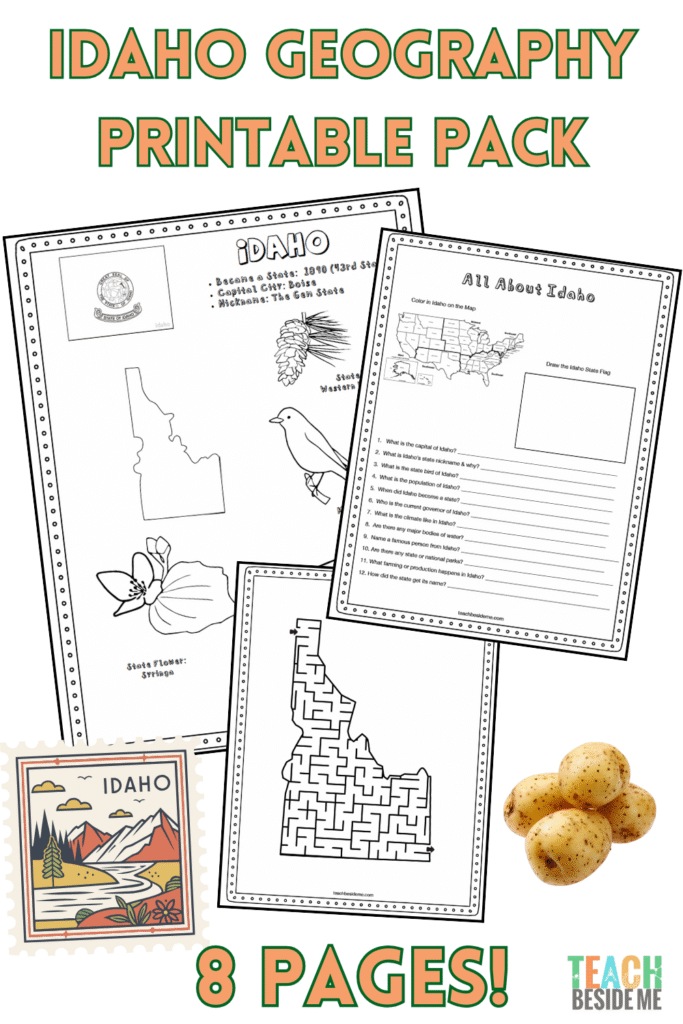
Idaho State Geography Printable Pack
This 8-page printable pack makes learning about Idaho fun and interactive. Kids will explore state facts, maps, and symbols while practicing research and creative skills.
What’s Inside:
-
Idaho Fact Coloring Sheet – bird, flower, flag, and animal
-
Northwestern U.S. Regional Map
-
State Landmark Coloring Page
-
Idaho Info Worksheet for research and review
-
Blank U.S. Map to locate Idaho
-
Idaho State Map – label the capital, cities, rivers, and mountains
-
Large Idaho State Flag Coloring Page
-
Idaho-Shaped Maze Activity
![]()
How to Use This Idaho Geography Pack
This set is easy to add to any geography or social studies lesson. Here’s a suggested flow:
-
Read the fun facts aloud to introduce the state.
-
Use the maps to show Idaho’s location in the U.S. and label key features.
-
Complete the info worksheet using an atlas or safe internet search.
-
Add creativity with the coloring and maze pages.
-
Extend the lesson with one of the read-aloud or virtual field trip suggestions below.
Recommended resources:
-
The 50 States by Gabrielle Balkan – for kid-friendly maps and illustrations
-
National Geographic Kids U.S. Atlas – great photos and facts
Idaho Geography Learning Extensions
Read-Aloud Pairing:
-
Thunder Rolling in the Mountains by Scott O’Dell – about the Nez Perce people
-
Mailing May by Michael O. Tunnell – based on the true story of a girl “mailed” to her grandmother in Idaho by train
- Animals of Idaho by Hope Aicher- This photo-packed book introduces young readers to the diverse wildlife of Idaho.
Virtual Field Trips:
-
Explore Shoshone Falls or Craters of the Moon National Monument online
-
Visit the Idaho Potato Museum website for a quirky cultural stop
Craft or Symbol Project:
-
Make a model or drawing of the Mountain Bluebird
-
Create a gemstone art project to connect with Idaho’s nickname
Math/Science Connections:
-
Compare Idaho’s potato production to other states in a simple bar graph
-
Research volcanoes and lava flows in the Craters of the Moon area
- Learn about and grow your own potatoes with this potato in a jar experiment +printable life cycle!
![]()
See More Geography Lessons
Previous State: Hawaii Geography Lesson
Next State: Illinois Geography Lesson