Build a City Map: Printable Geography Activity for Kids
This post may contain affiliate links.
Learning about maps is much more fun when kids get to create their own! This Build a City Map printable activity lets kids design a town, arrange buildings and landmarks, and explore basic geography and mapping skills through hands-on play.
Whether you’re teaching map skills in your homeschool or classroom, or simply looking for a creative activity for kids who love building and designing, this printable city map set makes geography interactive and fun!
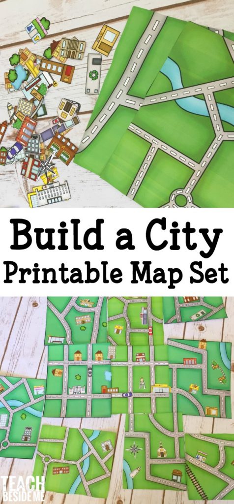
Build a City Map Printable Set
I created this printable geography activity to give kids the freedom to build and customize their own city maps.
The 15-page printable set includes:
- 5 different map pages, each available in color and black and white.
- 2 pages of buildings, cars, trees, and ponds for customizing the maps, also available in color and black and white.
- Plenty of opportunities for creative design, imaginative play, and geography learning!
Kids can arrange the pieces to create their own towns, neighborhoods, and cities.
Get the Build a City Map Printable Set Here!
You can print the colored version for a quick, ready-to-use activity, or choose the black-and-white pages so kids can color and decorate their own buildings and maps.
I love activities that combine creativity with learning, and this one gives kids lots of room to make their own design decisions.

How to Build Your Own City Map
This activity is easy to adapt for different ages and learning goals.
1. Choose a map. Print one of the five map designs. Kids can choose the layout they’d like to work with.
2. Prepare the city pieces. Print and cut out the buildings, cars, trees, and ponds. Younger children may need some help cutting.
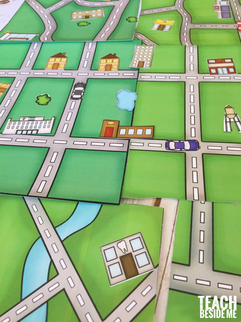
3. Design the city. Arrange the pieces on the map to create neighborhoods, roads, parks, and other features. Kids can experiment with different layouts before deciding where everything belongs.
4. Explore the map. Once the city is designed, use it to practice directions, identify landmarks, or tell stories about the places on the map.

Geography and Map Skills Kids Can Practice
Building a city map is more than a fun printable activity. It creates opportunities to introduce important geography concepts in a hands-on way.
Understanding Maps and Symbols
Talk about how maps represent real places from above. Explain that symbols and pictures can represent buildings, roads, parks, and other features.
Ask your kids which places they included in their city and how someone looking at the map would recognize them.
For an extra challenge, have kids create a simple map key or legend that explains the symbols on their map.
Practicing Directions
Once the city is built, practice giving directions from one location to another.
Try questions like:
- How would you get from the park to the school?
- Which building is closest to the pond?
- What is north of the library?
- Can you describe a route using left, right, and straight ahead?
You can also introduce the four cardinal directions—north, south, east, and west—and draw a compass rose on the map.
Learning About Communities
As kids arrange their city, encourage them to think about the places a community needs.
Where should the school go? What about a grocery store, hospital, or fire station? Should parks be near neighborhoods?
These questions encourage kids to think about how communities are organized and why the locations of buildings and services matter.
More Ways to Use This Printable Map Activity
One of my favorite things about this geography printable is how easily you can extend the learning.
Recreate your own town. Have kids think about familiar streets, buildings, and landmarks. They can use the printable pieces to create a simplified map inspired by their community.
Create a pretend-play city. Build a fictional town and use small toy cars or figures to travel between locations.
Give a map challenge. Ask kids to design a city with a park, school, shopping area, and several neighborhoods. Have them explain why they placed each feature where they did.
Add a little math. Count buildings, compare distances, or design city blocks with different shapes. Older kids can create a simple coordinate grid to identify locations.
Write about the city. Give the town a name, create a story about someone who lives there, or write directions for a visitor.
These extensions make the activity useful for geography, math, language arts, and imaginative play.
Get the Build a City Map Printable
Ready to make your own city?
My Build a City Map printable geography set includes 15 pages of maps and customizable city pieces, with both color and black-and-white options.
It’s a fun, flexible resource for introducing map skills, designing communities, and encouraging hands-on learning.
Get the Build a City Map Printable Here
This printable is also included in my Creative Teacher Club, along with my other printable resources, monthly Creative Learning Plans, and Cups & Classics collections.
More Hands-On Geography and Map Activities
If your kids enjoy building maps, try some of these other creative geography activities!
- Me on the Map Nesting Cans — Explore how our homes, communities, states, and countries fit together.
- Make a Treasure Map of Your Yard — Turn mapmaking into an outdoor adventure.
- Area and Perimeter City — Combine city design with hands-on math.
- I Spy With Google Earth — Explore famous landmarks and geography from above.
- Learn the 50 States: United States Geography Lessons & Activities for Kids
You can also explore more of my hands-on STEM activities for kids.





Hello Karyn. thanks a lot for sharing your wonderful ideas. I’m a special need teacher and i use you printabels. the kids enjoy them a lot. i would love to have the ‘Build a city’ printable. somehow, i don’t mange to get to the file. can you help me?
Limor
Yup! If you have already subscribed it is in the subscriber library. I will send you an email with the details in case you missed it in the email.
Hey there! I have subscribed as well, but I do not see the Building a map printable. Is this one I have to purchase?
Hi there! This set is just available for purchase.
Thank you for this- really made my life easier with regards to a current school project- although it would have been nice if the roads lined up. Despite this we had lots of fun with this- cut and paste, lining up and built a whole town- school project galore!!
How can I print the “Build A City”? I purchase it butI can’t seam to find how to download the print outs.
How do I print the city map. only option there is is to buy. please can you help