Hurricane Mapping STEM Activity for Kids
This post may contain affiliate links.
This post is sponsored by 4-H as part of an Influencer Activation for Influence Central. All opinions expressed are my own.
Today I want to show you how to use a hurricane map and track the path of hurricanes with your kids. Hurricane Mapping is an amazing educational STEM project for kids.

Hurricane season is a big deal to me. I grew up in Southern Florida, so each year, we would prepare for hurricane season. We would diligently track the hurricanes as they made their way through the ocean. While I no longer live in hurricane territory, I still watch the major hurricanes. I keep an eye on them as they track across the ocean. I have great concern for the people in their paths.
I am always looking for creative STEM activities to do with my kids. If you are interested in STEM projects, you should definitely stop by and visit the 4-H Stem Lab. It is a free resource for families and educators to use and is great to introduce kids of all ages to hands-on learning activities. These STEM projects and activities help kids practice critical thinking skills, instill creativity and help prepare them for the future.
How to Do the Hurricane Mapping Activity
I remember mapping Hurricane Andrew in my middle school science class. Each day we came to class, we would check the recent path of the hurricane and put a dot on our maps to see where it was now. I was lucky to not be in the direct path of that hurricane, but the destruction south of us was devastating. My parents went to Miami after the storm to help those in need.
Hurricanes are terrifying when you are in the path of them. You can prepare in some ways for the storms, but some storms are stronger than those preparations. Your best bet is leaving, not staying put. Having the technology to track and map these storms allows people to prepare and be ready to leave their homes if needed.

The Hurricane Mapping Activity we did comes from the 4-H STEM Lab. It is an awesome way to teach kids how to learn about so many different skills. Kids learn to use the Geographic Information System (GIS) by tracking the paths of some of the most destructive hurricanes in the United States history, Katrina and Rita from 2005. Kids will learn how to map the path of the hurricanes using latitude and longitude coordinates provided. The activity teaches how to compare the paths of the two different storms and learn how to use the data to prepare people for the storm and hopefully save lives.
![]()
This is a simple activity to do with kids, you just need a Hurricane Tracking Chart and a set of hurricane coordinates. Then we logged the path of the hurricane at the same time each day, putting one dot on for every 24 hour interval.

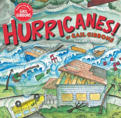
Extend the activity with this great book about Hurricanes by Gail Gibbons. I love pairing all of our learning activities with a good book!

More STEM Activities from the 4-H STEM Lab
The Hurricane Mapping activity is not the only awesome FREE STEM project available from the 4-H STEM Lab. They have so many good ones to explore and use. You’ll find projects with plant life cycles, building bridges, making robots and foamy fizzy fun!
There is a new one that just released at the end of November called Practicing Digital Citizenship. This project helps teach kids to properly interact online. This is such an important thing to teach kids! Since we live in such a digital world, so much of our interaction is happening online. Kids (and adults) need to learn appropriate behavior. WE need to teach them to avoid bullying and threatening and how to recognize inappropriate behavior. This activity includes a role-playing activity to help kids learn proper digital communication.
See more STEM Projects for Kids.


