Minnesota Geography for Kids: Printable State Learning Pack
This post may contain affiliate links.
Next in our U.S. Geography series is Minnesota! Known as the Land of 10,000 Lakes, Minnesota is famous for its beautiful freshwater lakes, forests, rivers, and wide-open prairies. Located in the Upper Midwest region of the United States, Minnesota is a wonderful state for exploring geography, freshwater ecosystems, glacial landforms, and natural resources.
This printable Minnesota geography pack helps kids learn about the state’s geography, landmarks, and symbols through maps, research, coloring, and hands-on learning activities.
Fun Facts About the State of Minnesota
Start your Minnesota state study with these interesting facts!
- Minnesota became the 32nd state to join the United States on May 11, 1858.
- The state capital is Saint Paul, while the largest city is Minneapolis. Together, they are known as the Twin Cities.
- Minnesota is nicknamed the Land of 10,000 Lakes, although it actually has more than 11,800 lakes measuring at least 10 acres.
- The state bird is the Common Loon, known for its haunting calls across Minnesota’s lakes.
- The state flower is the Pink and White Lady’s Slipper, a beautiful wild orchid.
- Minnesota borders North Dakota, South Dakota, Iowa, and Wisconsin, as well as the Canadian provinces of Manitoba and Ontario.
- The Mississippi River begins at Lake Itasca in northern Minnesota and flows more than 2,300 miles to the Gulf of Mexico.
- Minnesota borders Lake Superior, the largest freshwater lake in the world by surface area.
- The Boundary Waters Canoe Area Wilderness is famous for its interconnected lakes, forests, and canoe routes.
- Minnesota’s landscape was shaped by enormous glaciers during the last Ice Age.
- The state is home to Voyageurs National Park, where visitors explore lakes, islands, and waterways.
- Minnesota is an important agricultural state, producing crops such as corn, soybeans, wheat, and sugar beets.
- The state is also known for its iron ore deposits, particularly in the Mesabi Iron Range.
Minnesota Geography and Landscape
Minnesota is located in the Upper Midwest of the United States, along the Canadian border. Its landscape includes thousands of freshwater lakes, winding rivers, thick forests, rolling hills, and open prairies. Much of this geography was shaped by glaciers that covered the region during the last Ice Age.
As the glaciers moved across the land, they carved depressions into the ground and left behind deposits of rock and sediment. When the ice melted, many of these depressions filled with water, forming the lakes that give Minnesota its famous nickname. Today, these lakes provide important habitats for fish, birds, and other wildlife.
One of Minnesota’s most remarkable geographic features is the Mississippi River headwaters at Lake Itasca. Here, one of North America’s most important rivers begins as a relatively small stream before traveling south through the central United States to the Gulf of Mexico. Minnesota is also home to portions of the Minnesota River, Red River of the North, and St. Croix River.
In northeastern Minnesota, the landscape becomes rocky and heavily forested, with lakes and rugged terrain along the North Shore of Lake Superior. This region includes waterfalls, cliffs, and wilderness areas. The Boundary Waters Canoe Area Wilderness, near the Canadian border, contains a vast network of lakes and waterways surrounded by northern forests.
Southern and western Minnesota have more open landscapes, including fertile farmland and prairie regions. Agriculture is an important part of the state’s economy, while northern Minnesota is known for its forests, timber, and mineral resources. The Mesabi Iron Range has been an important source of iron ore used to produce steel.
Minnesota’s varied geography makes it an excellent place to study freshwater ecosystems, glacial landforms, watersheds, forests, agriculture, and the ways natural resources influence where people live and work.
Minnesota State Geography Printable Pack
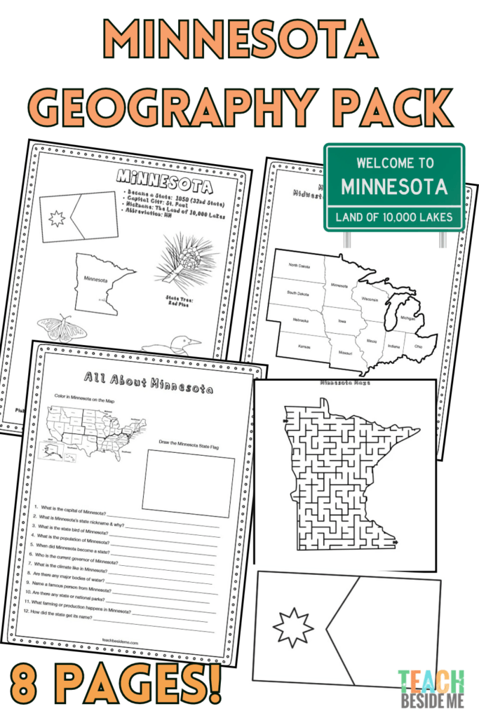
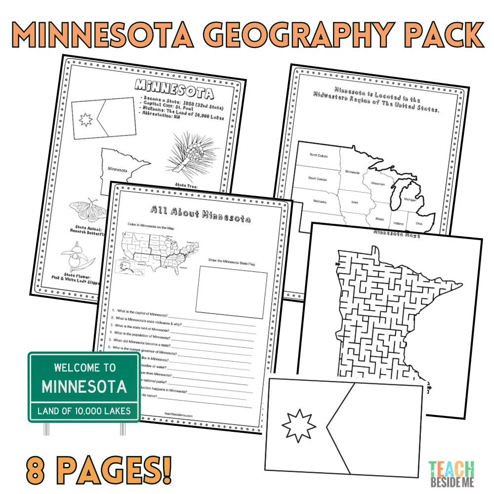
This 8-page printable geography pack helps students explore Minnesota through maps, research, and creative learning activities.
Included in this pack:
- Minnesota Fact Coloring Page featuring state symbols
- Midwestern States Regional Map
- Minnesota Landmark Coloring Page
- Minnesota Info Worksheet for student research
- Blank U.S. Map to locate Minnesota
- Minnesota State Map – label cities, rivers, lakes, and neighboring states
- Large Minnesota State Flag Coloring Page
- Minnesota-Shaped Maze Activity
How to Use This Geography Pack
This printable set works well for homeschool or classroom geography lessons.
- Begin by reading the Minnesota fun facts together.
- Locate Minnesota on the U.S. and regional maps.
- Find Lake Superior, Lake Itasca, the Mississippi River, and Minnesota’s neighboring states.
- Complete the research worksheet using an atlas or trusted online resources.
- Reinforce learning with the coloring pages and maze.
- Extend your state study with a hands-on freshwater ecosystem activity.
Recommended resources:
Find this printable pack in my shop now!

Minnesota Freshwater Ecosystems STEM Connection
With its thousands of lakes and rivers, Minnesota is a wonderful place to explore freshwater ecosystems. Lakes, rivers, and wetlands provide habitats for fish, frogs, turtles, aquatic insects, birds, and many other living things. These organisms depend on one another for food, shelter, and survival.
Explore these relationships with our Food Chain Game, a hands-on activity that helps kids understand how energy moves through an ecosystem. You can also use our Animal Habitat Sorting Mats to investigate where different animals live and how their habitats meet their needs.
Minnesota’s lakes and rivers are also part of larger watersheds, where rain and melting snow drain into connected waterways. Students can extend their learning by exploring how water moves across the land and why protecting freshwater habitats is important.
Minnesota Geography Learning Extensions
Read-Aloud Pairings
- One-Dog Canoe by Mary Casanova – a playful story that connects beautifully with Minnesota’s lakes and canoeing traditions.
- Minn of the Mississippi by Holling C. Holling – follow a turtle’s journey down the Mississippi River while exploring geography and natural history.
- Paddle-to-the-Sea by Holling C. Holling – follow a little wooden canoe through the Great Lakes and learn about the waterways of North America.
Virtual Field Trips
- Explore Itasca State Park and see the headwaters of the Mississippi River.
- Visit Voyageurs National Park to learn about Minnesota’s lakes, forests, and waterways.
- Explore the Boundary Waters Canoe Area Wilderness and its interconnected lakes.
- Take a virtual trip along the North Shore of Lake Superior to see waterfalls, cliffs, and rocky beaches.
Hands-On Activities
- Build a model watershed using crumpled paper, a spray bottle, and washable markers to investigate how water flows across the land.
- Create a map tracing the Mississippi River from Minnesota to the Gulf of Mexico.
- Make a freshwater lake habitat diorama featuring fish, plants, insects, and birds.
- Research how glaciers shaped Minnesota’s landscape and created thousands of lakes.
- Compare the geography of northern Minnesota’s forests with the agricultural prairies of southern and western Minnesota.
Cross-Curricular Connections
- Science: Investigate how glaciers form and how they change Earth’s surface.
- Geography: Trace the Mississippi River and identify the states it flows through or borders.
- Math: Compare the surface areas and depths of the five Great Lakes.
- Ecology: Study freshwater food chains and the importance of protecting lakes and rivers.
- History: Learn about the Dakota and Ojibwe peoples and their long histories in the region, including their relationships with Minnesota’s land and waterways.
More State Geography Lessons to Explore
- Michigan
- Massachusetts
- Maryland
- Maine
- Louisiana
- Kentucky
- United States Geography Series
- USA Landmarks Handwriting Practice
Continue through the entire 50 States Geography Series to explore the United States one state at a time!